
- Start >
- Rivers >
- Waterlevel >
- Isar >
- Plattling >
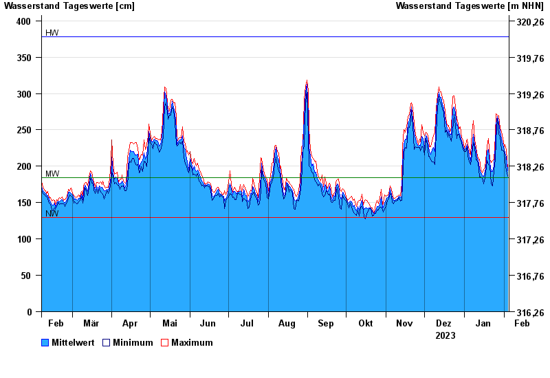
- Chart of year

Chart of year Plattling / Isar
Waterlevel from 05.02.2023 to 04.02.2024
| Date | Mean value [cm] | Maximum [cm] | Minimum [cm] |
|---|---|---|---|
| 04.02.2024 | 194 | 197 | 186 |
| 03.02.2024 | 213 | 222 | 194 |
| 02.02.2024 | 218 | 230 | 207 |
| 01.02.2024 | 223 | 227 | 218 |
| 31.01.2024 | 230 | 238 | 222 |
| 30.01.2024 | 238 | 248 | 222 |
| 29.01.2024 | 248 | 252 | 241 |
© Bayerisches Landesamt für Umwelt 2024