
- Start >
- Rivers >
- Waterlevel >
- Isar >
- Mittenwald >
- Chart of year

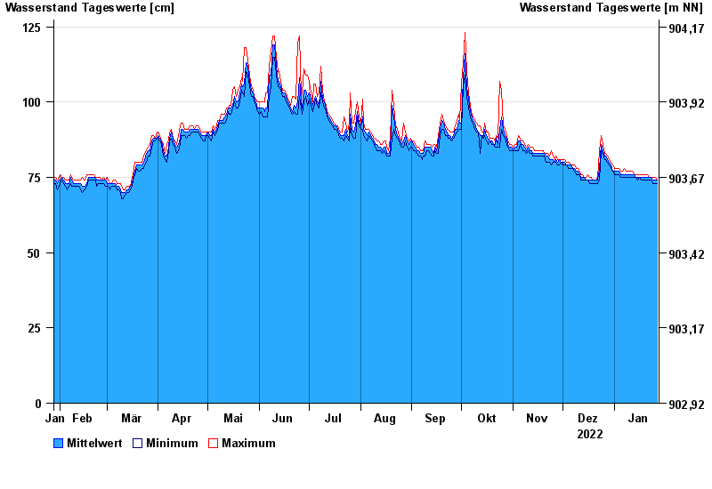
Chart of year Mittenwald / Isar
Waterlevel from 28.01.2022 to 27.01.2023
- Hochwassergefahrenfläche HQ100 290 cm
| Date | Mean value [cm] | Maximum [cm] | Minimum [cm] |
|---|---|---|---|
| 27.01.2023 | 74 | 74 | 73 |
| 26.01.2023 | 74 | 75 | 73 |
| 25.01.2023 | 74 | 75 | 73 |
| 24.01.2023 | 74 | 75 | 73 |
| 23.01.2023 | 75 | 75 | 74 |
| 22.01.2023 | 75 | 75 | 74 |
| 21.01.2023 | 75 | 76 | 74 |
© Bayerisches Landesamt für Umwelt 2024