
- Start >
- Rivers >
- Waterlevel >
- Isar >
- Lenggries >
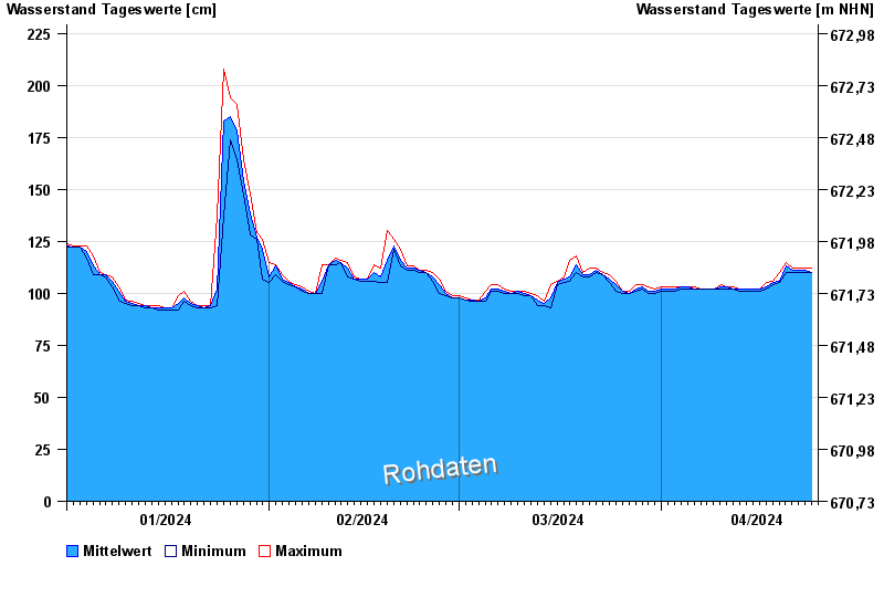
- Chart of year

Chart of year Lenggries / Isar
Waterlevel from 01.01.2024 to 24.04.2024
- 23.08.2005 Wasserstand: 421 cm
- 22.05.1999 Wasserstand: 371 cm
- 01.08.1977 Wasserstand: 352 cm
- 11.06.1965 Wasserstand: 348 cm
- 21.07.1981 Wasserstand: 333 cm
| Date | Mean value [cm] | Maximum [cm] | Minimum [cm] |
|---|---|---|---|
| 24.04.2024 | 110 | 111 | 110 |
| 23.04.2024 | 111 | 112 | 110 |
| 22.04.2024 | 111 | 112 | 110 |
| 21.04.2024 | 111 | 112 | 110 |
| 20.04.2024 | 113 | 115 | 110 |
| 19.04.2024 | 106 | 110 | 105 |
| 18.04.2024 | 105 | 106 | 104 |
© Bayerisches Landesamt für Umwelt 2024