
- Start >
- Rivers >
- Waterlevel >
- Isar >
- Lenggries >
- Current values

Current values Lenggries / Isar
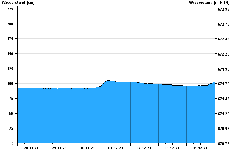
Waterlevel from 28.11.2021 to 04.12.2021
- 23.08.2005 Wasserstand: 421 cm
- 22.05.1999 Wasserstand: 371 cm
- 01.08.1977 Wasserstand: 352 cm
- 11.06.1965 Wasserstand: 348 cm
- 21.07.1981 Wasserstand: 333 cm
| Date | Waterlevel [cm] |
|---|---|
| 04.12.2021 23:45 | 102 |
| 04.12.2021 23:30 | 102 |
| 04.12.2021 23:15 | 102 |
| 04.12.2021 23:00 | 102 |
| 04.12.2021 22:45 | 102 |
| 04.12.2021 22:30 | 102 |
| 04.12.2021 22:15 | 101 |
© Bayerisches Landesamt für Umwelt 2024