
- Start >
- Rivers >
- Waterlevel >
- Isar >
- Langengeisling >
- Chart of year

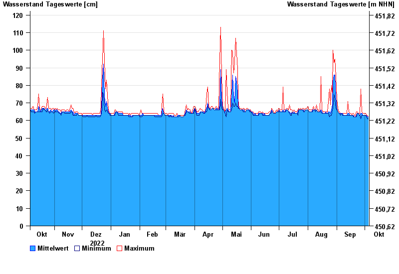
Chart of year Langengeisling / Saubach
Waterlevel from 06.10.2022 to 05.10.2023
- 03.06.2013 Wasserstand: 207 cm
- 02.08.1991 Wasserstand: 178 cm
- 15.02.1990 Wasserstand: 170 cm
- 07.06.1995 Wasserstand: 169 cm
- 31.01.1982 Wasserstand: 165 cm
| Date | Mean value [cm] | Maximum [cm] | Minimum [cm] |
|---|---|---|---|
| 05.10.2023 | 62 | 62 | 61 |
| 04.10.2023 | 62 | 63 | 61 |
| 03.10.2023 | 63 | 63 | 62 |
| 02.10.2023 | 63 | 64 | 63 |
| 01.10.2023 | 63 | 64 | 63 |
| 30.09.2023 | 63 | 64 | 63 |
| 29.09.2023 | 63 | 64 | 63 |
© Bayerisches Landesamt für Umwelt 2024