
- Start >
- Rivers >
- Waterlevel >
- Isar >
- Kochel >
- Chart of total period

Chart of total period Kochel / Loisach
Waterlevel from 01.11.1963 to 24.04.2024
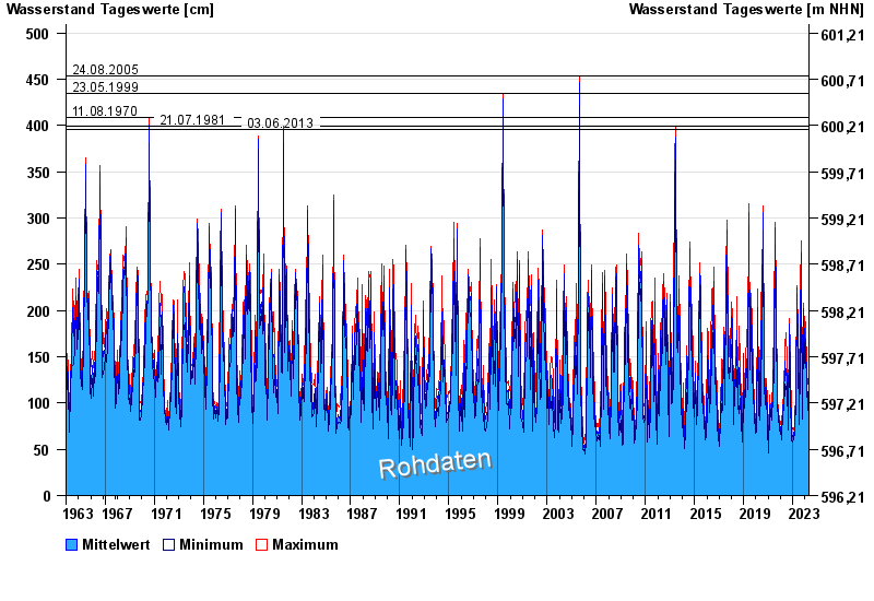
- 24.08.2005 Wasserstand: 454 cm
- 23.05.1999 Wasserstand: 435 cm
- 11.08.1970 Wasserstand: 409 cm
- 21.07.1981 Wasserstand: 399 cm
- 03.06.2013 Wasserstand: 396 cm
| Date | Mean value [cm] | Maximum [cm] | Minimum [cm] |
|---|---|---|---|
| 24.04.2024 | 90 | 97 | 85 |
| 23.04.2024 | 110 | 125 | 85 |
| 22.04.2024 | 69 | 85 | 62 |
| 21.04.2024 | 60 | 66 | 57 |
| 20.04.2024 | 69 | 83 | 61 |
| 19.04.2024 | 77 | 89 | 72 |
| 18.04.2024 | 89 | 91 | 88 |
© Bayerisches Landesamt für Umwelt 2024