
- Start >
- Rivers >
- Waterlevel >
- Isar >
- Kirchberg >
- Chart of month

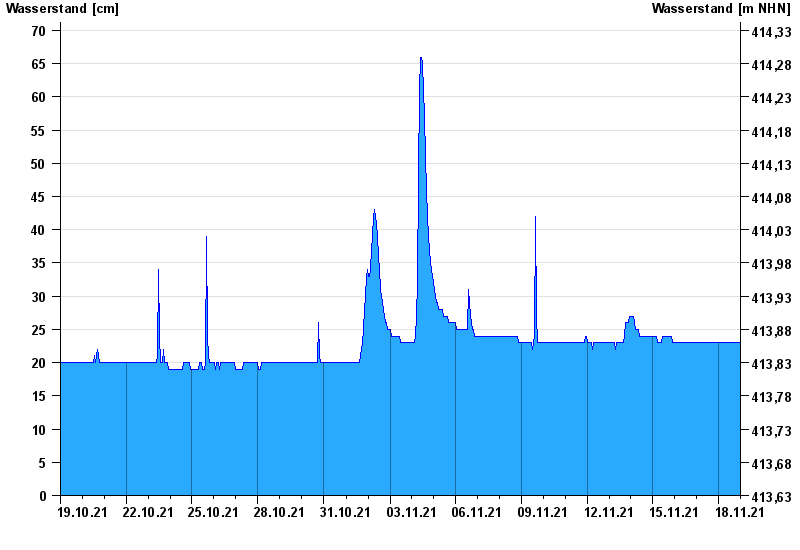
Chart of month Kirchberg / Mertseebach
Waterlevel from 19.10.2021 to 18.11.2021
- Hochwassergefahrenfläche HQ100 200 cm
| Date | Waterlevel [cm] |
|---|---|
| 18.11.2021 23:45 | 23 |
| 18.11.2021 23:30 | 23 |
| 18.11.2021 23:15 | 23 |
| 18.11.2021 23:00 | 23 |
| 18.11.2021 22:45 | 23 |
| 18.11.2021 22:30 | 23 |
| 18.11.2021 22:15 | 23 |
© Bayerisches Landesamt für Umwelt 2024