
- Start >
- Rivers >
- Waterlevel >
- Isar >
- Inkofen >
- Chart of year

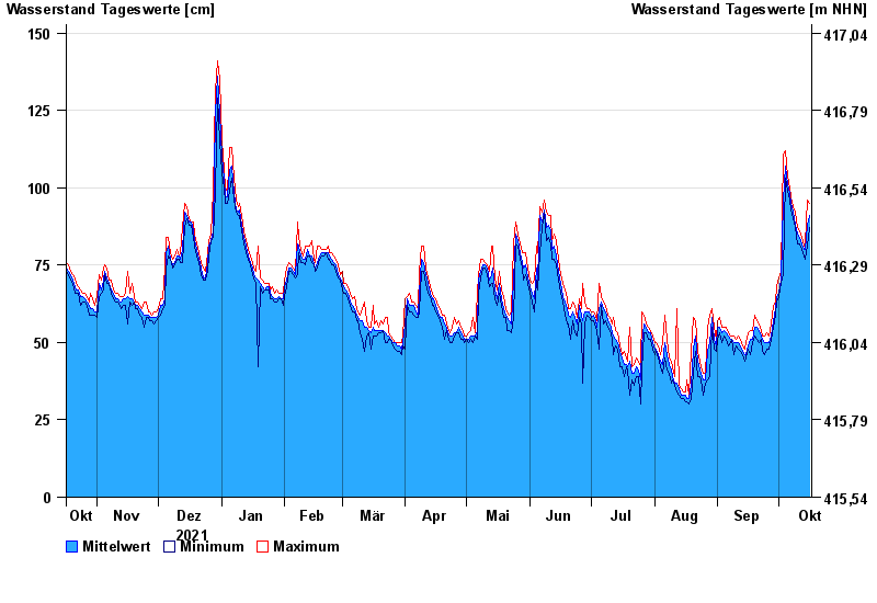
Chart of year Inkofen / Amper
Waterlevel from 17.10.2021 to 16.10.2022
- 15.04.1994 Wasserstand: 366 cm
- 04.06.2013 Wasserstand: 364 cm
- 12.06.1965 Wasserstand: 333 cm
- 26.05.1999 Wasserstand: 315 cm
- 02.06.1965 Wasserstand: 313 cm
| Date | Mean value [cm] | Maximum [cm] | Minimum [cm] |
|---|---|---|---|
| 16.10.2022 | 91 | 95 | 87 |
| 15.10.2022 | 88 | 96 | 81 |
| 14.10.2022 | 80 | 82 | 77 |
| 13.10.2022 | 80 | 81 | 78 |
| 12.10.2022 | 82 | 84 | 80 |
| 11.10.2022 | 84 | 86 | 82 |
| 10.10.2022 | 85 | 87 | 82 |
© Bayerisches Landesamt für Umwelt 2024