
- Start >
- Rivers >
- Waterlevel >
- Isar >
- Dietelskirchen >
- Chart of year

Chart of year Dietelskirchen / Kleine Vils
Waterlevel from 01.01.2021 to 31.12.2021
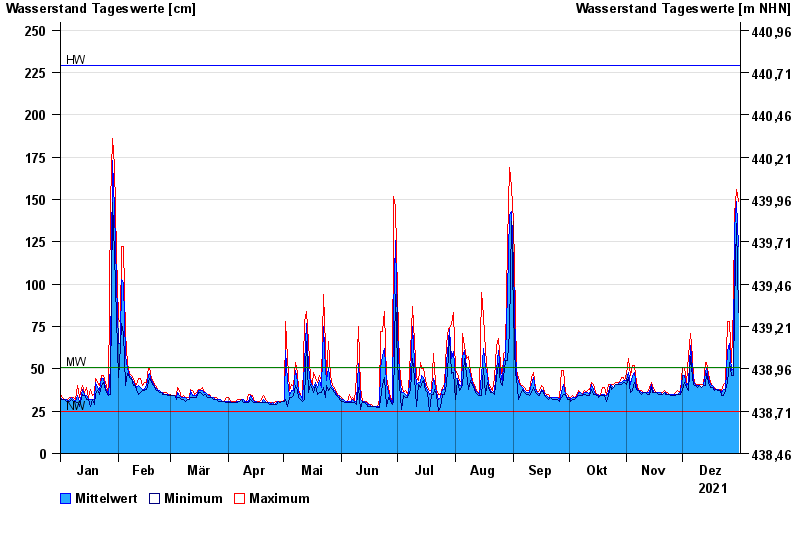
| Date | Mean value [cm] | Maximum [cm] | Minimum [cm] |
|---|---|---|---|
| 31.12.2021 | 122 | 149 | 83 |
| 30.12.2021 | 149 | 156 | 136 |
| 29.12.2021 | 132 | 141 | 87 |
| 28.12.2021 | 50 | 87 | 46 |
| 27.12.2021 | 49 | 54 | 46 |
| 26.12.2021 | 65 | 78 | 54 |
| 25.12.2021 | 61 | 78 | 42 |
© Bayerisches Landesamt für Umwelt 2024