
- Start >
- Rivers >
- Waterlevel >
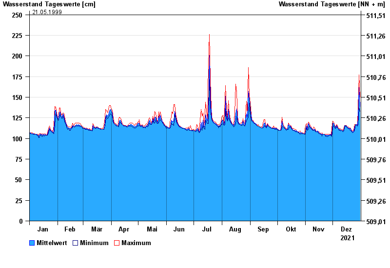
- Isar >
- Bleyerbrücke >
- Chart of year

Chart of year Bleyerbrücke / Kieferbach
Waterlevel from 01.01.2021 to 31.12.2021
- 02.06.2013 Wasserstand: 274 cm
- 23.06.1970 Wasserstand: 262 cm
- 20.07.1981 Wasserstand: 260 cm
- 01.08.1977 Wasserstand: 254 cm
- 21.05.1999 Wasserstand: 250 cm
| Date | Mean value [cm] | Maximum [cm] | Minimum [cm] |
|---|---|---|---|
| 31.12.2021 | 139 | 150 | 133 |
| 30.12.2021 | 162 | 177 | 137 |
| 29.12.2021 | 126 | 137 | 117 |
| 28.12.2021 | 116 | 117 | 115 |
| 27.12.2021 | 117 | 117 | 116 |
| 26.12.2021 | 117 | 117 | 117 |
| 25.12.2021 | 114 | 117 | 110 |
© Bayerisches Landesamt für Umwelt 2024