
- Start >
- Rivers >
- Waterlevel >
- Isar >
- Bergkirchen >
- Chart of total period

Chart of total period Bergkirchen / Maisach
Waterlevel from 01.11.1969 to 25.04.2024
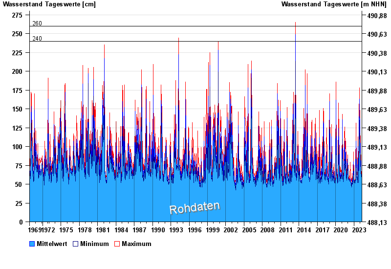
- 240 cm: Günding: Gefahr der Überflutung Wohngebiet Poitstr.,Bulachstr., Weidenweg
| Date | Mean value [cm] | Maximum [cm] | Minimum [cm] |
|---|---|---|---|
| 25.04.2024 | 55 | 55 | 55 |
| 24.04.2024 | 55 | 56 | 55 |
| 23.04.2024 | 56 | 56 | 55 |
| 22.04.2024 | 56 | 57 | 55 |
| 21.04.2024 | 56 | 57 | 56 |
| 20.04.2024 | 57 | 58 | 57 |
| 19.04.2024 | 57 | 58 | 57 |
© Bayerisches Landesamt für Umwelt 2024