
- Start >
- Rivers >
- Waterlevel >
- Isar >
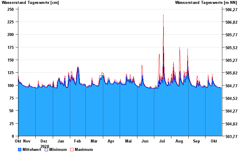
- Bad Trißl >
- Chart of year

Chart of year Bad Trißl / Auerbach
Waterlevel from 31.10.2020 to 30.10.2021
- 20.02.1999 Wasserstand: 337 cm
- 30.01.2000 Wasserstand: 298 cm
- 21.05.1999 Wasserstand: 279 cm
- 22.12.1991 Wasserstand: 276 cm
- 12.08.2002 Wasserstand: 264 cm
| Date | Mean value [cm] | Maximum [cm] | Minimum [cm] |
|---|---|---|---|
| 30.10.2021 | 95 | 95 | 95 |
| 29.10.2021 | 95 | 95 | 95 |
| 28.10.2021 | 95 | 95 | 95 |
| 27.10.2021 | 95 | 96 | 95 |
| 26.10.2021 | 96 | 96 | 95 |
| 25.10.2021 | 96 | 96 | 96 |
| 24.10.2021 | 96 | 96 | 96 |
© Bayerisches Landesamt für Umwelt 2024