
- Start >
- Rivers >
- Waterlevel >
- Isar >
- Bad Aibling >
- Chart of year

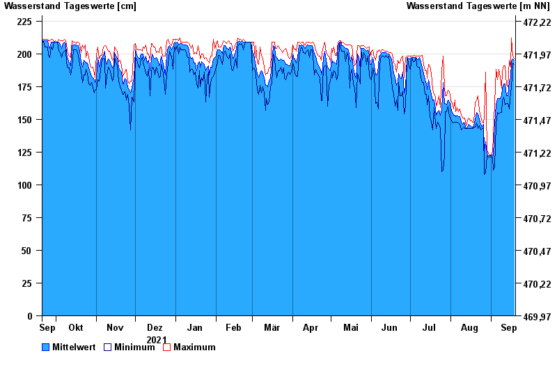
Chart of year Bad Aibling / Triftbach linker Mühlkanal
Waterlevel from 20.09.2021 to 19.09.2022
- 02.06.2013 Wasserstand: 332 cm
- 10.08.1970 Wasserstand: 280 cm
- 22.05.1999 Wasserstand: 275 cm
- 18.06.1979 Wasserstand: 270 cm
- 20.07.1981 Wasserstand: 261 cm
| Date | Mean value [cm] | Maximum [cm] | Minimum [cm] |
|---|---|---|---|
| 19.09.2022 | 195 | 196 | 192 |
| 18.09.2022 | 196 | 198 | 193 |
| 17.09.2022 | 194 | 212 | 174 |
| 16.09.2022 | 181 | 190 | 171 |
| 15.09.2022 | 179 | 195 | 158 |
| 14.09.2022 | 168 | 175 | 162 |
| 13.09.2022 | 168 | 176 | 162 |
© Bayerisches Landesamt für Umwelt 2024