
- Start >
- Rivers >
- Waterlevel >
- Isar >
- Bad Aibling >
- Chart of year

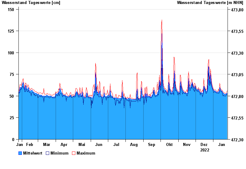
Chart of year Bad Aibling / Glonn
Waterlevel from 26.01.2022 to 25.01.2023
- Hochwassergefahrenfläche HQ100 290 cm
| Date | Mean value [cm] | Maximum [cm] | Minimum [cm] |
|---|---|---|---|
| 25.01.2023 | 53 | 56 | 51 |
| 24.01.2023 | 53 | 54 | 52 |
| 23.01.2023 | 52 | 53 | 50 |
| 22.01.2023 | 52 | 53 | 50 |
| 21.01.2023 | 52 | 53 | 50 |
| 20.01.2023 | 52 | 54 | 50 |
| 19.01.2023 | 53 | 54 | 51 |
© Bayerisches Landesamt für Umwelt 2024