
- Start >
- Rivers >
- Waterlevel >
- Inn >
- Weg >
- Chart of year

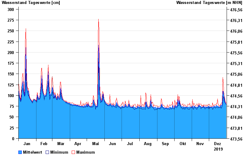
Chart of year Weg / Isen
Waterlevel from 01.01.2019 to 31.12.2019
- 22.06.1975 Wasserstand: 375 cm
- 22.08.1977 Wasserstand: 355 cm
- 01.08.1991 Wasserstand: 332 cm
- 04.08.1973 Wasserstand: 332 cm
- 15.02.1990 Wasserstand: 330 cm
| Date | Mean value [cm] | Maximum [cm] | Minimum [cm] |
|---|---|---|---|
| 31.12.2019 | 80 | 82 | 79 |
| 30.12.2019 | 82 | 85 | 81 |
| 29.12.2019 | 86 | 89 | 84 |
| 28.12.2019 | 92 | 97 | 84 |
| 27.12.2019 | 97 | 99 | 94 |
| 26.12.2019 | 109 | 127 | 97 |
| 25.12.2019 | 110 | 142 | 83 |
© Bayerisches Landesamt für Umwelt 2024