
- Start >
- Rivers >
- Waterlevel >
- Inn >
- Wasserburg >
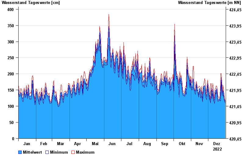
- Chart of year

Chart of year Wasserburg / Inn
Waterlevel from 01.01.2022 to 31.12.2022
- 23.08.2005 Wasserstand: 719 cm
- 07.08.1985 Wasserstand: 670 cm
- 21.05.1999 Wasserstand: 638 cm
- 02.06.2013 Wasserstand: 630 cm
- 20.07.1981 Wasserstand: 615 cm
| Date | Mean value [cm] | Maximum [cm] | Minimum [cm] |
|---|---|---|---|
| 31.12.2022 | 113 | 116 | 110 |
| 30.12.2022 | 120 | 125 | 115 |
| 29.12.2022 | 125 | 135 | 119 |
| 28.12.2022 | 140 | 147 | 135 |
| 27.12.2022 | 149 | 164 | 132 |
| 26.12.2022 | 136 | 144 | 132 |
| 25.12.2022 | 160 | 175 | 141 |
© Bayerisches Landesamt für Umwelt 2024