
- Start >
- Rivers >
- Waterlevel >
- Inn >
- Trostberg >
- Chart of year

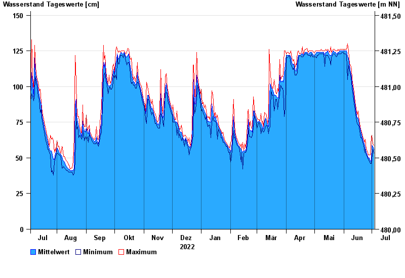
Chart of year Trostberg / Alzkanal
Waterlevel from 04.07.2022 to 03.07.2023
- 00.00.0000 Wasserstand: cm
- 00.00.0000 Wasserstand: cm
- 00.00.0000 Wasserstand: cm
- 00.00.0000 Wasserstand: cm
- 00.00.0000 Wasserstand: cm
| Date | Mean value [cm] | Maximum [cm] | Minimum [cm] |
|---|---|---|---|
| 03.07.2023 | 56 | 59 | 53 |
| 02.07.2023 | 58 | 60 | 56 |
| 01.07.2023 | 59 | 66 | 49 |
| 30.06.2023 | 48 | 65 | 46 |
| 29.06.2023 | 48 | 52 | 46 |
| 28.06.2023 | 50 | 52 | 48 |
| 27.06.2023 | 50 | 52 | 49 |
© Bayerisches Landesamt für Umwelt 2024