
- Start >
- Rivers >
- Waterlevel >
- Inn >
- Staufeneck >
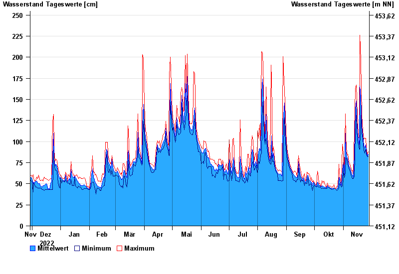
- Chart of year

Chart of year Staufeneck / Saalach
Waterlevel from 29.11.2022 to 28.11.2023
- 14.09.1899 Wasserstand: 551 cm
- 05.07.1918 Wasserstand: 494 cm
- 07.09.1920 Wasserstand: 489 cm
- 07.08.1905 Wasserstand: 486 cm
- 31.07.1924 Wasserstand: 481 cm
| Date | Mean value [cm] | Maximum [cm] | Minimum [cm] |
|---|---|---|---|
| 28.11.2023 | 85 | 88 | 82 |
| 27.11.2023 | 83 | 85 | 82 |
| 26.11.2023 | 88 | 92 | 85 |
| 25.11.2023 | 96 | 104 | 91 |
| 24.11.2023 | 93 | 104 | 86 |
| 23.11.2023 | 95 | 103 | 90 |
| 22.11.2023 | 107 | 112 | 103 |
© Bayerisches Landesamt für Umwelt 2024