
- Start >
- Rivers >
- Waterlevel >
- Inn >
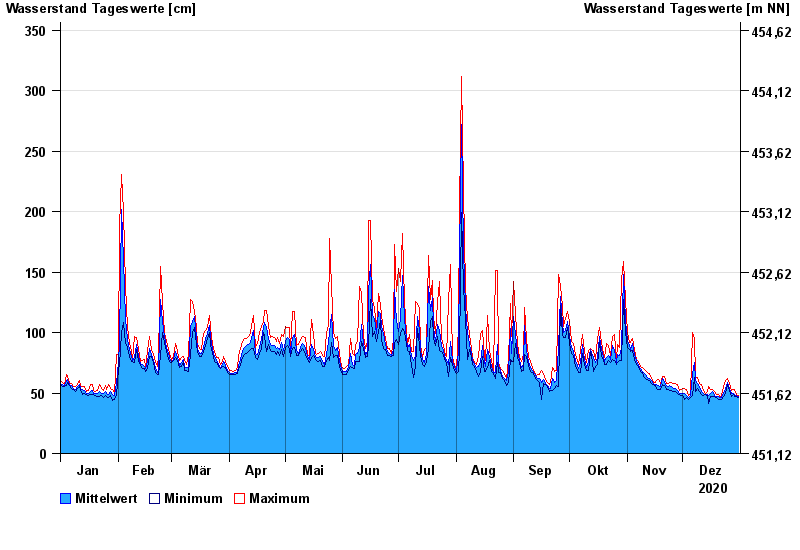
- Staufeneck >
- Chart of year

Chart of year Staufeneck / Saalach
Waterlevel from 01.01.2020 to 31.12.2020
- 14.09.1899 Wasserstand: 551 cm
- 05.07.1918 Wasserstand: 494 cm
- 07.09.1920 Wasserstand: 489 cm
- 07.08.1905 Wasserstand: 486 cm
- 31.07.1924 Wasserstand: 481 cm
| Date | Mean value [cm] | Maximum [cm] | Minimum [cm] |
|---|---|---|---|
| 31.12.2020 | 47 | 48 | 46 |
| 30.12.2020 | 48 | 49 | 47 |
| 29.12.2020 | 49 | 53 | 47 |
| 28.12.2020 | 50 | 53 | 49 |
| 27.12.2020 | 50 | 52 | 47 |
| 26.12.2020 | 54 | 58 | 52 |
| 25.12.2020 | 59 | 62 | 57 |
© Bayerisches Landesamt für Umwelt 2024