
- Start >
- Rivers >
- Waterlevel >
- Inn >
- Staufeneck >
- Chart of month

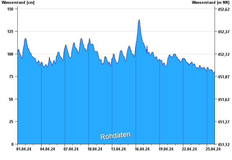
Chart of month Staufeneck / Saalach
Waterlevel from 01.04.2024 to 25.04.2024
- Hochwassergefahrenfläche HQ100 490 cm
| Date | Waterlevel [cm] |
|---|---|
| 25.04.2024 22:15 | 79 |
| 25.04.2024 22:00 | 78 |
| 25.04.2024 21:45 | 78 |
| 25.04.2024 21:30 | 78 |
| 25.04.2024 21:15 | 78 |
| 25.04.2024 21:00 | 78 |
| 25.04.2024 20:45 | 78 |
© Bayerisches Landesamt für Umwelt 2024