
- Start >
- Rivers >
- Waterlevel >
- Inn >
- Stauden >
- Chart of month

Chart of month Stauden / Leitzach
Waterlevel from 01.08.2021 to 31.08.2021
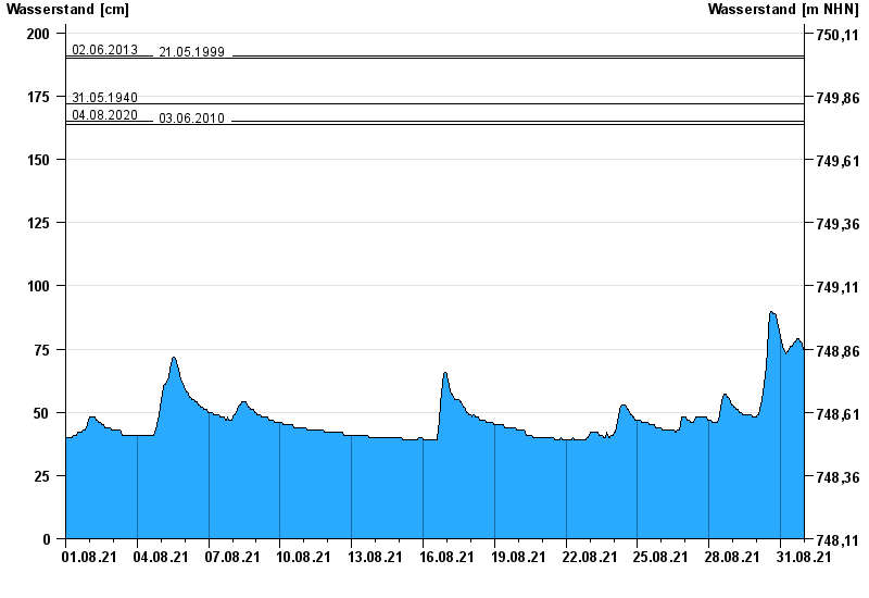
- 02.06.2013 Wasserstand: 191 cm
- 21.05.1999 Wasserstand: 190 cm
- 31.05.1940 Wasserstand: 172 cm
- 04.08.2020 Wasserstand: 165 cm
- 03.06.2010 Wasserstand: 164 cm
| Date | Waterlevel [cm] |
|---|---|
| 01.09.2021 00:45 | 72 |
| 01.09.2021 00:30 | 73 |
| 01.09.2021 00:15 | 73 |
| 01.09.2021 00:00 | 73 |
| 31.08.2021 23:45 | 74 |
| 31.08.2021 23:30 | 74 |
| 31.08.2021 23:15 | 74 |
© Bayerisches Landesamt für Umwelt 2024