
- Start >
- Rivers >
- Waterlevel >
- Inn >
- Staudach >
- Chart of year

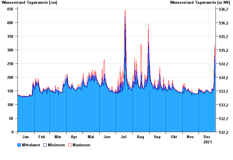
Chart of year Staudach / Tiroler Achen
Waterlevel from 01.01.2021 to 31.12.2021
- 02.06.2013 Wasserstand: 675 cm
- 12.08.2002 Wasserstand: 577 cm
- 03.06.2010 Wasserstand: 571 cm
- 23.12.1991 Wasserstand: 564 cm
- 03.08.1991 Wasserstand: 532 cm
| Date | Mean value [cm] | Maximum [cm] | Minimum [cm] |
|---|---|---|---|
| 31.12.2021 | 234 | 272 | 213 |
| 30.12.2021 | 279 | 319 | 190 |
| 29.12.2021 | 178 | 200 | 154 |
| 28.12.2021 | 153 | 154 | 152 |
| 27.12.2021 | 156 | 157 | 154 |
| 26.12.2021 | 157 | 158 | 155 |
| 25.12.2021 | 155 | 160 | 146 |
© Bayerisches Landesamt für Umwelt 2024