
- Start >
- Rivers >
- Waterlevel >
- Inn >
- Piding >
- Chart of month

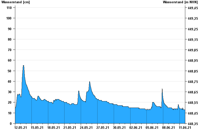
Chart of month Piding / Stoißer Ache
Waterlevel from 12.05.2021 to 11.06.2021
- 04.08.2020 Wasserstand: 235 cm
- 20.08.1974 Wasserstand: 225 cm
- 12.08.2002 Wasserstand: 212 cm
- 09.08.1977 Wasserstand: 210 cm
- 01.08.1977 Wasserstand: 203 cm
| Date | Waterlevel [cm] |
|---|---|
| 12.06.2021 00:45 | 13 |
| 12.06.2021 00:30 | 13 |
| 12.06.2021 00:15 | 13 |
| 12.06.2021 00:00 | 13 |
| 11.06.2021 23:45 | 13 |
| 11.06.2021 23:30 | 13 |
| 11.06.2021 23:15 | 13 |
© Bayerisches Landesamt für Umwelt 2024