
- Start >
- Rivers >
- Waterlevel >
- Inn >
- Passau Ingling >
- Chart of month

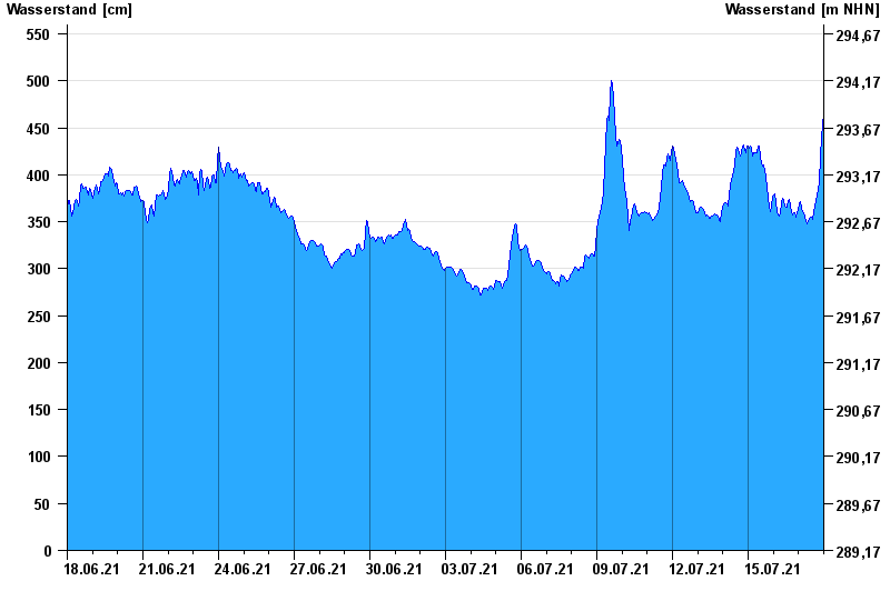
Chart of month Passau Ingling / Inn
Waterlevel from 18.06.2021 to 17.07.2021
- Hochwassergefahrenfläche HQ100 1140 cm
| Date | Waterlevel [cm] |
|---|---|
| 18.07.2021 00:45 | 498 |
| 18.07.2021 00:30 | 490 |
| 18.07.2021 00:15 | 482 |
| 18.07.2021 00:00 | 474 |
| 17.07.2021 23:45 | 466 |
| 17.07.2021 23:30 | 457 |
| 17.07.2021 23:15 | 452 |
© Bayerisches Landesamt für Umwelt 2024