
- Start >
- Rivers >
- Waterlevel >
- Inn >
- Passau Ilzstadt >
- Chart of year

Chart of year Passau Ilzstadt / Donau
Waterlevel from 18.07.2019 to 17.07.2020
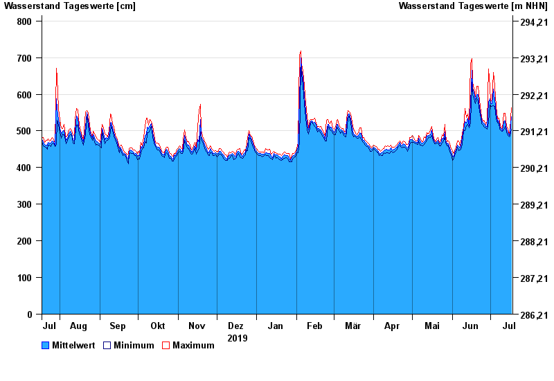
| Date | Mean value [cm] | Maximum [cm] | Minimum [cm] |
|---|---|---|---|
| 17.07.2020 | 538 | 563 | 504 |
| 16.07.2020 | 496 | 504 | 486 |
| 15.07.2020 | 488 | 492 | 483 |
| 14.07.2020 | 495 | 504 | 488 |
| 13.07.2020 | 503 | 512 | 497 |
| 12.07.2020 | 528 | 548 | 512 |
| 11.07.2020 | 525 | 549 | 503 |
© Bayerisches Landesamt für Umwelt 2024