
- Start >
- Rivers >
- Waterlevel >
- Inn >
- Mühldorf >
- Chart of year

Chart of year Mühldorf / Inn
Waterlevel from 19.01.2021 to 18.01.2022
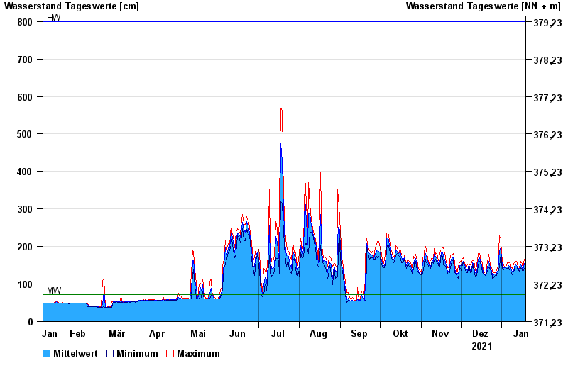
| Date | Mean value [cm] | Maximum [cm] | Minimum [cm] |
|---|---|---|---|
| 18.01.2022 | 155 | 167 | 141 |
| 17.01.2022 | 138 | 146 | 133 |
| 16.01.2022 | 148 | 159 | 140 |
| 15.01.2022 | 154 | 161 | 143 |
| 14.01.2022 | 140 | 143 | 135 |
| 13.01.2022 | 144 | 148 | 140 |
| 12.01.2022 | 150 | 160 | 146 |
© Bayerisches Landesamt für Umwelt 2024