
- Start >
- Rivers >
- Waterlevel >
- Inn >
- Mühldorf >
- Chart of year

Chart of year Mühldorf / Inn
Waterlevel from 01.01.2021 to 31.12.2021
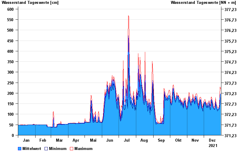
| Date | Mean value [cm] | Maximum [cm] | Minimum [cm] |
|---|---|---|---|
| 31.12.2021 | 197 | 220 | 178 |
| 30.12.2021 | 191 | 229 | 148 |
| 29.12.2021 | 136 | 148 | 130 |
| 28.12.2021 | 129 | 137 | 123 |
| 27.12.2021 | 127 | 131 | 122 |
| 26.12.2021 | 124 | 131 | 118 |
| 25.12.2021 | 123 | 134 | 115 |
© Bayerisches Landesamt für Umwelt 2024