
- Start >
- Rivers >
- Waterlevel >
- Inn >
- Mühldorf >
- Chart of year

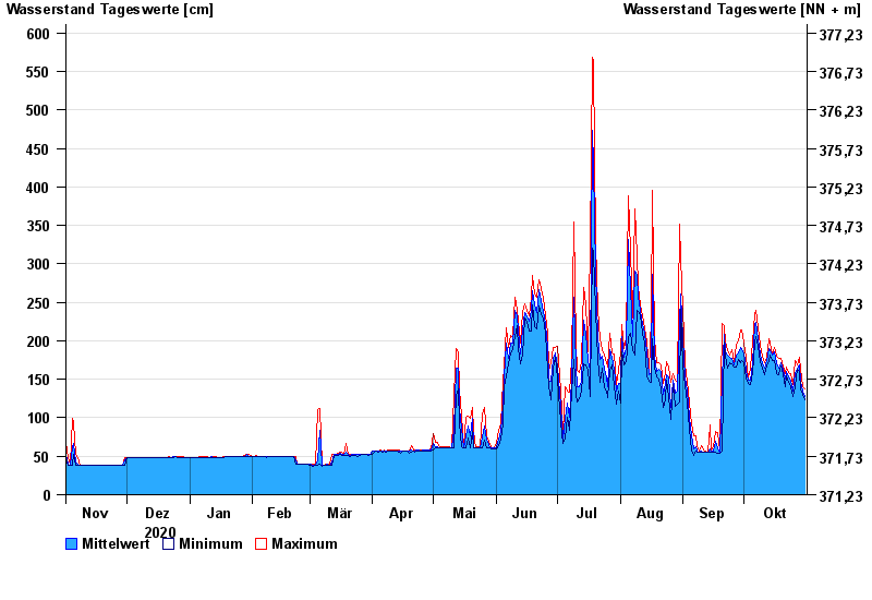
Chart of year Mühldorf / Inn
Waterlevel from 01.11.2020 to 31.10.2021
- 24.08.2005 Wasserstand: 799 cm
- 07.08.1985 Wasserstand: 766 cm
- 03.06.2013 Wasserstand: 708 cm
- 20.07.1981 Wasserstand: 677 cm
- 22.05.1999 Wasserstand: 662 cm
| Date | Mean value [cm] | Maximum [cm] | Minimum [cm] |
|---|---|---|---|
| 31.10.2021 | 127 | 137 | 123 |
| 30.10.2021 | 135 | 141 | 131 |
| 29.10.2021 | 148 | 163 | 136 |
| 28.10.2021 | 168 | 179 | 160 |
| 27.10.2021 | 165 | 169 | 163 |
| 26.10.2021 | 157 | 174 | 140 |
| 25.10.2021 | 135 | 143 | 128 |
© Bayerisches Landesamt für Umwelt 2024