
- Start >
- Rivers >
- Waterlevel >
- Inn >
- Mühldorf >
- Chart of year

Chart of year Mühldorf / Inn
Waterlevel from 22.09.2021 to 21.09.2022
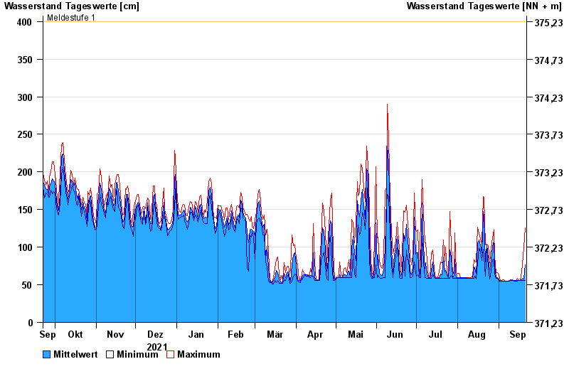
- Meldestufe 1 400 cm
- Hochwassergefahrenfläche HQ100 800 cm
| Date | Mean value [cm] | Maximum [cm] | Minimum [cm] |
|---|---|---|---|
| 21.09.2022 | 77 | 126 | 56 |
| 20.09.2022 | 58 | 99 | 56 |
| 19.09.2022 | 59 | 77 | 56 |
| 18.09.2022 | 58 | 67 | 56 |
| 17.09.2022 | 56 | 56 | 56 |
| 16.09.2022 | 56 | 56 | 56 |
| 15.09.2022 | 56 | 59 | 55 |
© Bayerisches Landesamt für Umwelt 2024