
- Start >
- Rivers >
- Waterlevel >
- Inn >
- Mühldorf >
- Chart of total period

Chart of total period Mühldorf / Inn
Waterlevel from 01.11.1969 to 16.04.2024
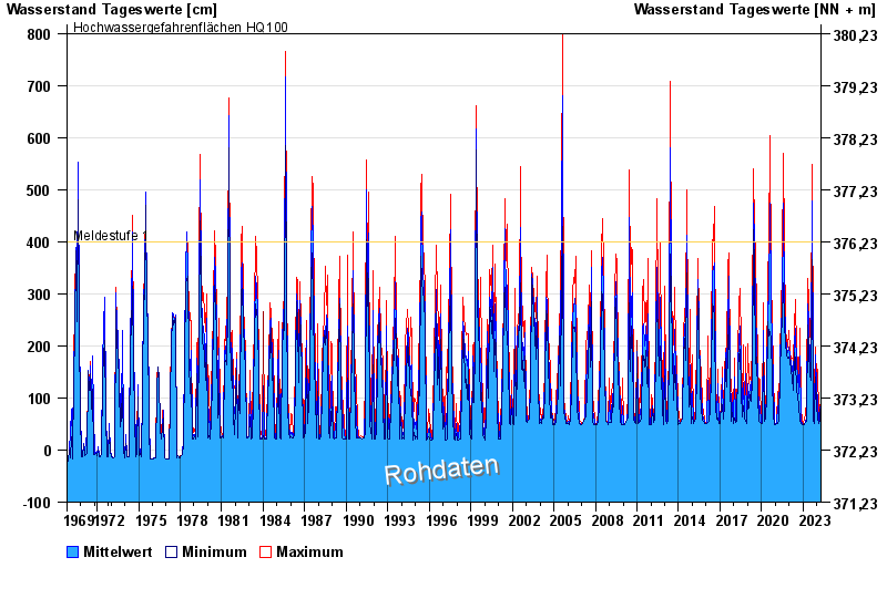
- Meldestufe 1 400 cm
- Hochwassergefahrenfläche HQ100 800 cm
| Date | Mean value [cm] | Maximum [cm] | Minimum [cm] |
|---|---|---|---|
| 16.04.2024 | 105 | 110 | 102 |
| 15.04.2024 | 84 | 115 | 57 |
| 14.04.2024 | 57 | 57 | 57 |
| 13.04.2024 | 57 | 57 | 57 |
| 12.04.2024 | 57 | 57 | 57 |
| 11.04.2024 | 57 | 63 | 57 |
| 10.04.2024 | 78 | 103 | 57 |
© Bayerisches Landesamt für Umwelt 2024