
- Start >
- Rivers >
- Waterlevel >
- Inn >
- Langengeisling >
- Chart of year

Chart of year Langengeisling / Sempt
Waterlevel from 25.10.2021 to 24.10.2022
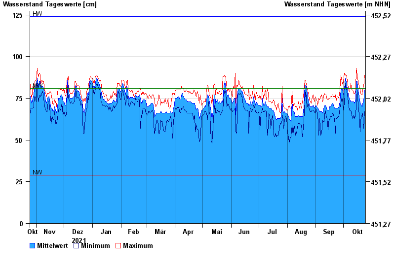
| Date | Mean value [cm] | Maximum [cm] | Minimum [cm] |
|---|---|---|---|
| 24.10.2022 | 80 | 89 | 67 |
| 23.10.2022 | 73 | 82 | 57 |
| 22.10.2022 | 72 | 80 | 66 |
| 21.10.2022 | 70 | 77 | 65 |
| 20.10.2022 | 71 | 77 | 65 |
| 19.10.2022 | 72 | 80 | 55 |
| 18.10.2022 | 76 | 82 | 65 |
© Bayerisches Landesamt für Umwelt 2024