
- Start >
- Rivers >
- Waterlevel >
- Inn >
- Langengeisling >
- Chart of year

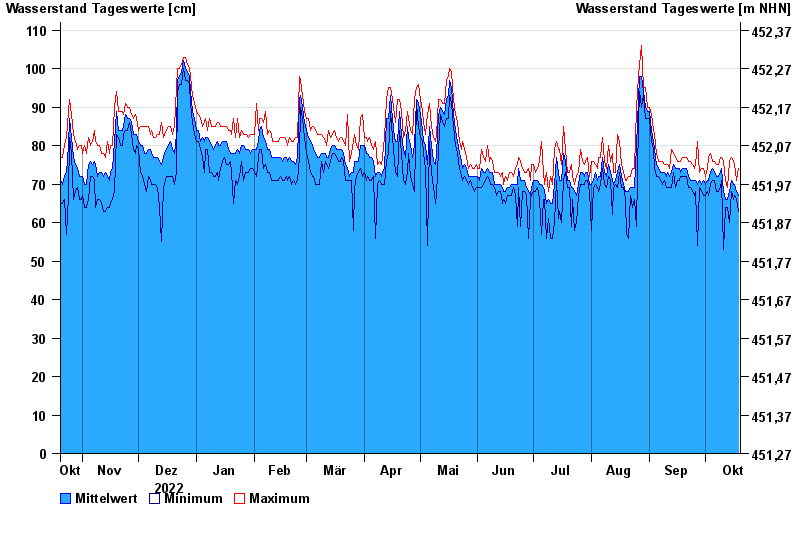
Chart of year Langengeisling / Sempt
Waterlevel from 20.10.2022 to 19.10.2023
- 08.01.1985 Wasserstand: 124 cm
- 27.10.1978 Wasserstand: 123 cm
- 29.06.1995 Wasserstand: 121 cm
- 02.06.2013 Wasserstand: 120 cm
- 30.09.1978 Wasserstand: 119 cm
| Date | Mean value [cm] | Maximum [cm] | Minimum [cm] |
|---|---|---|---|
| 19.10.2023 | 67 | 74 | 63 |
| 18.10.2023 | 68 | 71 | 66 |
| 17.10.2023 | 70 | 75 | 67 |
| 16.10.2023 | 70 | 76 | 66 |
| 15.10.2023 | 71 | 77 | 68 |
| 14.10.2023 | 68 | 76 | 60 |
| 13.10.2023 | 66 | 69 | 64 |
© Bayerisches Landesamt für Umwelt 2024