
- Start >
- Rivers >
- Waterlevel >
- Inn >
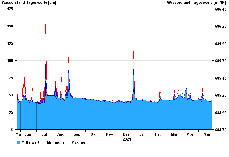
- Fritz am Sand >
- Chart of year

Chart of year Fritz am Sand / Weiße Traun
Waterlevel from 26.05.2021 to 25.05.2022
- Hochwassergefahrenfläche HQ100 220 cm
| Date | Mean value [cm] | Maximum [cm] | Minimum [cm] |
|---|---|---|---|
| 25.05.2022 | 42 | 43 | 41 |
| 24.05.2022 | 41 | 43 | 41 |
| 23.05.2022 | 41 | 43 | 40 |
| 22.05.2022 | 41 | 43 | 37 |
| 21.05.2022 | 41 | 42 | 41 |
| 20.05.2022 | 41 | 41 | 40 |
| 19.05.2022 | 41 | 41 | 40 |
© Bayerisches Landesamt für Umwelt 2024