
- Start >
- Rivers >
- Waterlevel >
- Inn >
- Eschelbach >
- Chart of year

Chart of year Eschelbach / Inn
Waterlevel from 20.05.2022 to 19.05.2023
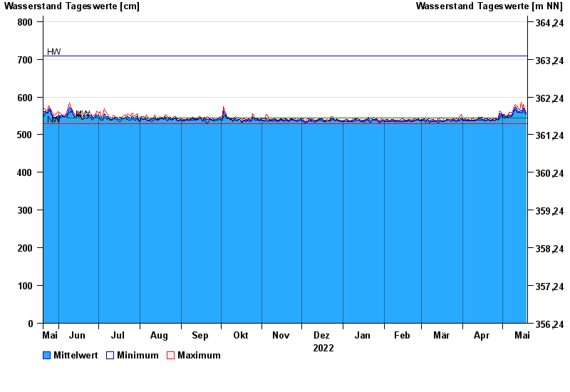
| Date | Mean value [cm] | Maximum [cm] | Minimum [cm] |
|---|---|---|---|
| 19.05.2023 | 556 | 558 | 554 |
| 18.05.2023 | 563 | 569 | 558 |
| 17.05.2023 | 571 | 580 | 564 |
| 16.05.2023 | 565 | 569 | 560 |
| 15.05.2023 | 565 | 586 | 558 |
| 14.05.2023 | 562 | 565 | 559 |
| 13.05.2023 | 563 | 569 | 559 |
© Bayerisches Landesamt für Umwelt 2024