
- Start >
- Rivers >
- Waterlevel >
- Inn >
- Bayerwald >
- Chart of total period

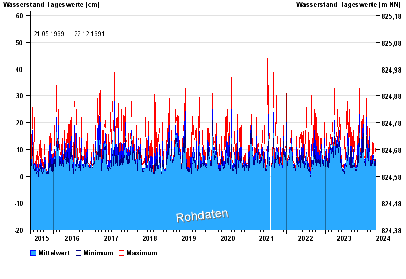
Chart of total period Bayerwald / Innerer Grüneckgraben
Waterlevel from 02.06.2015 to 18.04.2024
- 15.08.1993 Wasserstand: 80 cm
- 29.05.2007 Wasserstand: 66 cm
- 12.06.2007 Wasserstand: 63 cm
- 21.05.1999 Wasserstand: 52 cm
- 22.12.1991 Wasserstand: 52 cm
| Date | Mean value [cm] | Maximum [cm] | Minimum [cm] |
|---|---|---|---|
| 18.04.2024 | 8 | 9 | 8 |
| 17.04.2024 | 8 | 11 | 4 |
| 16.04.2024 | 4 | 5 | 4 |
| 15.04.2024 | 4 | 10 | 3 |
| 14.04.2024 | 3 | 3 | 3 |
| 13.04.2024 | 4 | 4 | 3 |
| 12.04.2024 | 4 | 4 | 3 |
© Bayerisches Landesamt für Umwelt 2024