
- Start >
- Rivers >
- Waterlevel >
- Inn >
- Bad Kreuth >
- Chart of month

Chart of month Bad Kreuth / Sagenbach
Waterlevel from 01.10.2021 to 30.10.2021
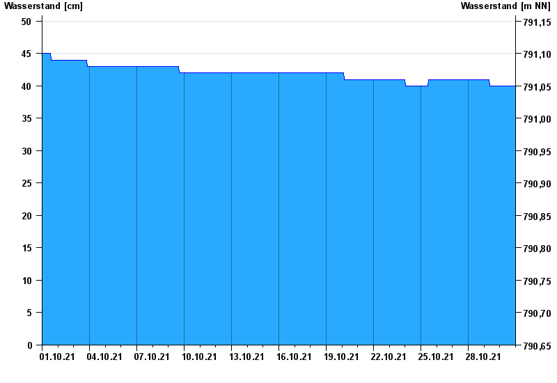
- Hochwassergefahrenfläche HQ100 140 cm
| Date | Waterlevel [cm] |
|---|---|
| 31.10.2021 00:45 | 40 |
| 31.10.2021 00:30 | 40 |
| 31.10.2021 00:15 | 40 |
| 31.10.2021 00:00 | 40 |
| 30.10.2021 23:45 | 40 |
| 30.10.2021 23:30 | 40 |
| 30.10.2021 23:15 | 40 |
© Bayerisches Landesamt für Umwelt 2024