
- Start >
- Rivers >
- Waterlevel >
- Iller - Lech - Bodensee >
- Rosenheim o.d. Mangfallmündung >
- Chart of year

Chart of year Rosenheim o.d. Mangfallmündung / Inn
Waterlevel from 01.01.2024 to 16.04.2024
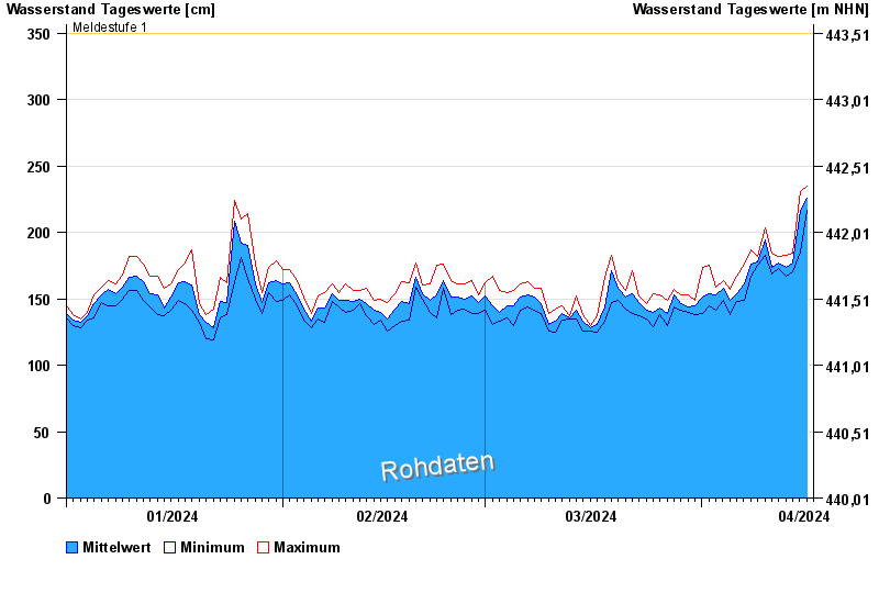
- Meldestufe 1 350 cm
- Meldestufe 2 400 cm
- Meldestufe 3 500 cm
- Hochwassergefahrenfläche HQ100 570 cm
| Date | Mean value [cm] | Maximum [cm] | Minimum [cm] |
|---|---|---|---|
| 16.04.2024 | 226 | 231 | 218 |
| 15.04.2024 | 217 | 231 | 185 |
| 14.04.2024 | 177 | 184 | 170 |
| 13.04.2024 | 174 | 183 | 167 |
| 12.04.2024 | 177 | 182 | 173 |
| 11.04.2024 | 174 | 184 | 169 |
| 10.04.2024 | 194 | 203 | 183 |
© Bayerisches Landesamt für Umwelt 2024