
- Start >
- Rivers >
- Waterlevel >
- Iller - Lech - Bodensee >
- Reckenberg >
- Chart of year

Chart of year Reckenberg / Ostrach
Waterlevel from 01.02.2023 to 31.01.2024
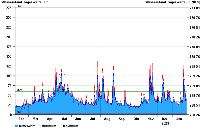
| Date | Mean value [cm] | Maximum [cm] | Minimum [cm] |
|---|---|---|---|
| 31.01.2024 | 39 | 40 | 35 |
| 30.01.2024 | 41 | 43 | 39 |
| 29.01.2024 | 46 | 52 | 35 |
| 28.01.2024 | 54 | 60 | 45 |
| 27.01.2024 | 73 | 90 | 60 |
| 26.01.2024 | 77 | 90 | 69 |
| 25.01.2024 | 106 | 128 | 84 |
© Bayerisches Landesamt für Umwelt 2024