
- Start >
- Rivers >
- Waterlevel >
- Iller - Lech - Bodensee >
- Reckenberg >
- Chart of year

Chart of year Reckenberg / Ostrach
Waterlevel from 18.05.2022 to 17.05.2023
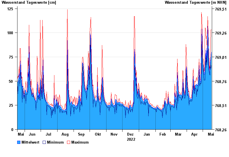
| Date | Mean value [cm] | Maximum [cm] | Minimum [cm] |
|---|---|---|---|
| 17.05.2023 | 80 | 103 | 66 |
| 16.05.2023 | 73 | 103 | 63 |
| 15.05.2023 | 70 | 73 | 67 |
| 14.05.2023 | 59 | 67 | 56 |
| 13.05.2023 | 60 | 62 | 58 |
| 12.05.2023 | 68 | 78 | 62 |
| 11.05.2023 | 92 | 101 | 78 |
© Bayerisches Landesamt für Umwelt 2024