
- Start >
- Rivers >
- Waterlevel >
- Iller - Lech - Bodensee >
- Pfronten Ried >
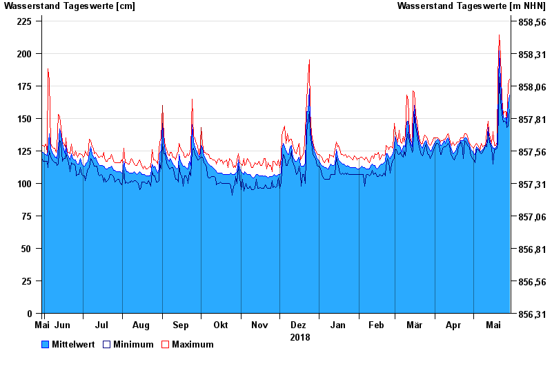
- Chart of year

Chart of year Pfronten Ried / Vils
Waterlevel from 30.05.2018 to 29.05.2019
- 22.05.1999 Wasserstand: 330 cm
- 22.08.2005 Wasserstand: 296 cm
- 06.08.2000 Wasserstand: 292 cm
- 12.08.2002 Wasserstand: 284 cm
- 13.05.1999 Wasserstand: 278 cm
| Date | Mean value [cm] | Maximum [cm] | Minimum [cm] |
|---|---|---|---|
| 29.05.2019 | 168 | 180 | 157 |
| 28.05.2019 | 161 | 176 | 144 |
| 27.05.2019 | 146 | 148 | 143 |
| 26.05.2019 | 151 | 155 | 147 |
| 25.05.2019 | 150 | 155 | 148 |
| 24.05.2019 | 151 | 153 | 147 |
| 23.05.2019 | 159 | 165 | 153 |
© Bayerisches Landesamt für Umwelt 2024