
- Start >
- Rivers >
- Waterlevel >
- Iller - Lech - Bodensee >
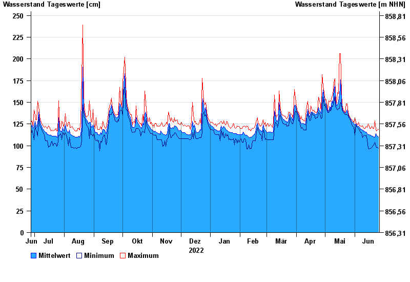
- Pfronten Ried >
- Chart of year

Chart of year Pfronten Ried / Vils
Waterlevel from 27.06.2022 to 26.06.2023
| Date | Mean value [cm] | Maximum [cm] | Minimum [cm] |
|---|---|---|---|
| 26.06.2023 | 110 | 119 | 97 |
| 25.06.2023 | 111 | 118 | 98 |
| 24.06.2023 | 112 | 117 | 98 |
| 23.06.2023 | 114 | 119 | 100 |
| 22.06.2023 | 110 | 129 | 104 |
| 21.06.2023 | 110 | 120 | 101 |
| 20.06.2023 | 111 | 120 | 100 |
© Bayerisches Landesamt für Umwelt 2024