
- Start >
- Rivers >
- Waterlevel >
- Iller - Lech - Bodensee >
- Leuterschach >
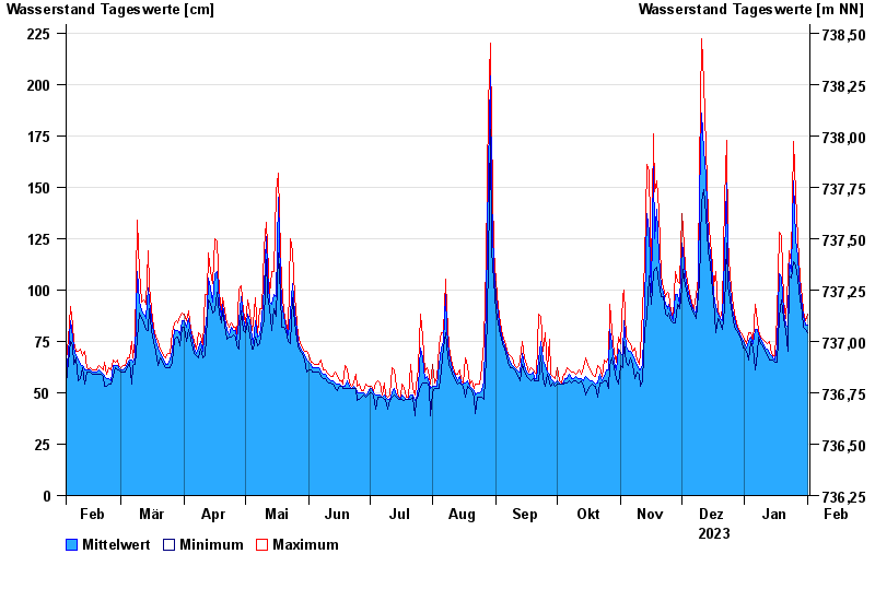
- Chart of year

Chart of year Leuterschach / Lobach
Waterlevel from 02.02.2023 to 01.02.2024
- Hochwassergefahrenfläche HQ100 280 cm
| Date | Mean value [cm] | Maximum [cm] | Minimum [cm] |
|---|---|---|---|
| 01.02.2024 | 83 | 88 | 79 |
| 31.01.2024 | 83 | 85 | 81 |
| 30.01.2024 | 87 | 90 | 82 |
| 29.01.2024 | 92 | 96 | 89 |
| 28.01.2024 | 100 | 106 | 95 |
| 27.01.2024 | 116 | 125 | 105 |
| 26.01.2024 | 125 | 147 | 112 |
© Bayerisches Landesamt für Umwelt 2024