
- Start >
- Rivers >
- Waterlevel >
- Iller - Lech - Bodensee >
- Lauben >
- Chart of year

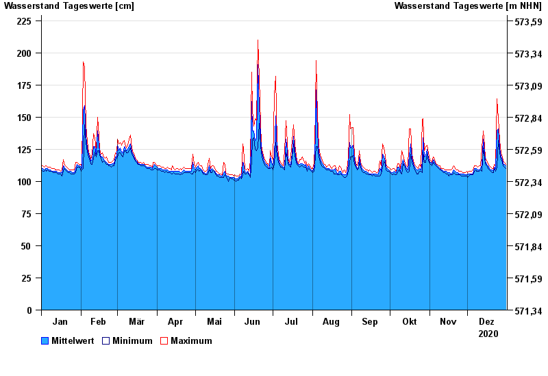
Chart of year Lauben / Günz
Waterlevel from 01.01.2020 to 31.12.2020
- 236 cm: Babenhausen: Ausuferungen am Mühlkanal (Fabrikstraße)
| Date | Mean value [cm] | Maximum [cm] | Minimum [cm] |
|---|---|---|---|
| 31.12.2020 | 112 | 113 | 110 |
| 30.12.2020 | 113 | 115 | 111 |
| 29.12.2020 | 114 | 116 | 112 |
| 28.12.2020 | 117 | 119 | 115 |
| 27.12.2020 | 119 | 122 | 117 |
| 26.12.2020 | 126 | 132 | 122 |
| 25.12.2020 | 141 | 149 | 132 |
© Bayerisches Landesamt für Umwelt 2024