
- Start >
- Rivers >
- Waterlevel >
- Iller - Lech - Bodensee >
- Donauwörth >
- Chart of year

Chart of year Donauwörth / Donau
Waterlevel from 01.01.2018 to 31.12.2018
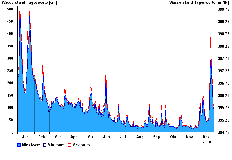
| Date | Mean value [cm] | Maximum [cm] | Minimum [cm] |
|---|---|---|---|
| 31.12.2018 | 91 | 94 | 89 |
| 30.12.2018 | 98 | 106 | 94 |
| 29.12.2018 | 114 | 128 | 106 |
| 28.12.2018 | 150 | 183 | 128 |
| 27.12.2018 | 205 | 224 | 183 |
| 26.12.2018 | 247 | 262 | 224 |
| 25.12.2018 | 323 | 390 | 249 |
© Bayerisches Landesamt für Umwelt 2024