
- Start >
- Rivers >
- Waterlevel >
- Iller - Lech - Bodensee >
- Donauwörth >
- Chart of year

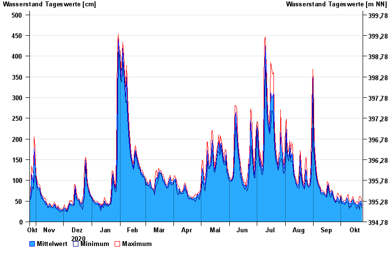
Chart of year Donauwörth / Donau
Waterlevel from 25.10.2020 to 24.10.2021
- 14.04.1994 Wasserstand: 577 cm
- 16.02.1990 Wasserstand: 553 cm
- 24.05.1999 Wasserstand: 552 cm
- 27.03.1988 Wasserstand: 544 cm
- 01.02.1982 Wasserstand: 543 cm
| Date | Mean value [cm] | Maximum [cm] | Minimum [cm] |
|---|---|---|---|
| 24.10.2021 | 41 | 50 | 33 |
| 23.10.2021 | 51 | 60 | 44 |
| 22.10.2021 | 49 | 60 | 43 |
| 21.10.2021 | 44 | 61 | 29 |
| 20.10.2021 | 42 | 44 | 40 |
| 19.10.2021 | 41 | 48 | 36 |
| 18.10.2021 | 40 | 48 | 31 |
© Bayerisches Landesamt für Umwelt 2024