
- Start >
- Rivers >
- Waterlevel >
- Iller - Lech - Bodensee >
- Arzberg >
- Chart of year

Chart of year Arzberg / Röslau
Waterlevel from 01.01.2021 to 31.12.2021
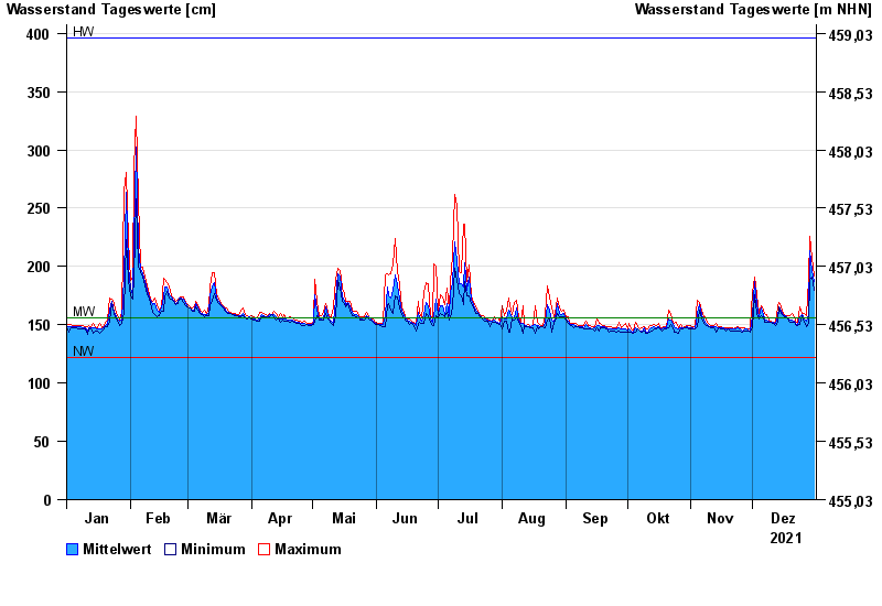
| Date | Mean value [cm] | Maximum [cm] | Minimum [cm] |
|---|---|---|---|
| 31.12.2021 | 187 | 192 | 180 |
| 30.12.2021 | 197 | 208 | 191 |
| 29.12.2021 | 214 | 226 | 189 |
| 28.12.2021 | 159 | 189 | 151 |
| 27.12.2021 | 153 | 158 | 148 |
| 26.12.2021 | 155 | 160 | 152 |
| 25.12.2021 | 159 | 160 | 158 |
© Bayerisches Landesamt für Umwelt 2024