
- Start >
- Rivers >
- Waterlevel >
- Oberer Main - Elbe >
- Windischeschenbach >
- Chart of total period

Chart of total period Windischeschenbach / Waldnaab
Waterlevel from 01.11.1984 to 25.04.2024
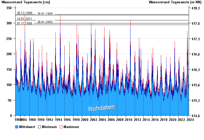
- 30.12.1986 Wasserstand: 328 cm
- 26.01.1995 Wasserstand: 326 cm
- 14.01.2011 Wasserstand: 309 cm
- 28.01.2002 Wasserstand: 299 cm
- 01.11.1998 Wasserstand: 294 cm
| Date | Mean value [cm] | Maximum [cm] | Minimum [cm] |
|---|---|---|---|
| 25.04.2024 | 90 | 92 | 87 |
| 24.04.2024 | 93 | 97 | 88 |
| 23.04.2024 | 99 | 105 | 94 |
| 22.04.2024 | 103 | 106 | 98 |
| 21.04.2024 | 96 | 105 | 91 |
| 20.04.2024 | 97 | 101 | 84 |
| 19.04.2024 | 74 | 83 | 66 |
© Bayerisches Landesamt für Umwelt 2024