
- Start >
- Rivers >
- Waterlevel >
- Oberer Main - Elbe >
- Wasserburg >
- Chart of year

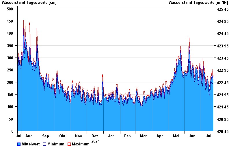
Chart of year Wasserburg / Inn
Waterlevel from 25.07.2021 to 24.07.2022
- 23.08.2005 Wasserstand: 719 cm
- 07.08.1985 Wasserstand: 670 cm
- 21.05.1999 Wasserstand: 638 cm
- 02.06.2013 Wasserstand: 630 cm
- 20.07.1981 Wasserstand: 615 cm
| Date | Mean value [cm] | Maximum [cm] | Minimum [cm] |
|---|---|---|---|
| 24.07.2022 | 206 | 223 | 181 |
| 23.07.2022 | 230 | 253 | 196 |
| 22.07.2022 | 211 | 223 | 193 |
| 21.07.2022 | 224 | 240 | 200 |
| 20.07.2022 | 207 | 222 | 197 |
| 19.07.2022 | 211 | 224 | 199 |
| 18.07.2022 | 188 | 212 | 156 |
© Bayerisches Landesamt für Umwelt 2024