
- Start >
- Rivers >
- Waterlevel >
- Oberer Main - Elbe >
- Wasserburg >
- Chart of year

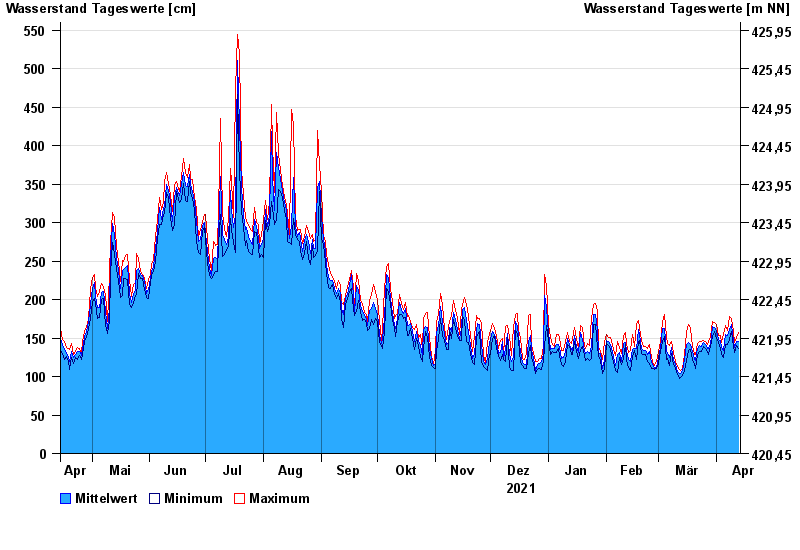
Chart of year Wasserburg / Inn
Waterlevel from 14.04.2021 to 13.04.2022
- 23.08.2005 Wasserstand: 719 cm
- 07.08.1985 Wasserstand: 670 cm
- 21.05.1999 Wasserstand: 638 cm
- 02.06.2013 Wasserstand: 630 cm
- 20.07.1981 Wasserstand: 615 cm
| Date | Mean value [cm] | Maximum [cm] | Minimum [cm] |
|---|---|---|---|
| 13.04.2022 | 146 | 157 | 136 |
| 12.04.2022 | 145 | 151 | 140 |
| 11.04.2022 | 138 | 144 | 131 |
| 10.04.2022 | 146 | 158 | 139 |
| 09.04.2022 | 168 | 175 | 158 |
| 08.04.2022 | 161 | 178 | 148 |
| 07.04.2022 | 153 | 160 | 142 |
© Bayerisches Landesamt für Umwelt 2024