
- Start >
- Rivers >
- Waterlevel >
- Oberer Main - Elbe >
- Waldsassen >
- Chart of month

Chart of month Waldsassen / Wondreb
Waterlevel from 01.06.2021 to 30.06.2021
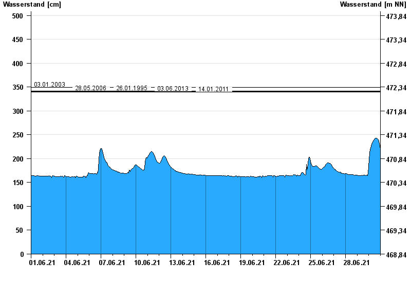
- 03.01.2003 Wasserstand: 349 cm
- 28.05.2006 Wasserstand: 342 cm
- 26.01.1995 Wasserstand: 342 cm
- 03.06.2013 Wasserstand: 341 cm
- 14.01.2011 Wasserstand: 340 cm
| Date | Waterlevel [cm] |
|---|---|
| 01.07.2021 00:45 | 212 |
| 01.07.2021 00:30 | 213 |
| 01.07.2021 00:15 | 215 |
| 01.07.2021 00:00 | 216 |
| 30.06.2021 23:45 | 218 |
| 30.06.2021 23:30 | 219 |
| 30.06.2021 23:15 | 221 |
© Bayerisches Landesamt für Umwelt 2024